The Darrington Trail, also known as the Salmon Falls Trail, is a popular biking trail outside the small town of Cool.
The Darrington Trail follows alongside the South Fork of the American River and past Folsom Lake, weaving through ravines, woods and meadows. The first mile of the Darrington Trail features the most technical riding and the difficulty eases as the trail progresses. There is some thrilling exposure along portions of the Darrington Trail, where the edge of the trail abruptly drops more than 50 feet down to the river.
The Darrington Trail is usually ridden as an out and back with a turn-around at Peninsula Campground. The ride can be cut in half by leaving a car shuttle at the campground.
Details
Length:
9 - 18 miles 9 miles is one way and 18 miles is out and back
Difficulty:
Exposure
Aerobic Difficulty:
Moderate
Time To Allow:
2 - 4 hours Depends on route taken and rider ability level
Season:
Year Round
Additional Details:
The Darrington Trail is multi-use and riders should understand and practice appropriate right of way protocol. Riders should also carry a first aid kit, bike repair kit and extra water and food.
Puget SoundThe Kitsap Peninsula is for those who are drawn to the sea. Located in the heart of Puget Sound, the Peninsula is surrounded by over 300 miles of shoreline and is situated between the dramatic mountain Olympic and Cascade mountains ranges of Washington. Request this Free Visitor GuideRequested!You're all set! Request a few more Visitor Guides, or complete the form below to receive your guides by mail.
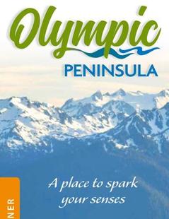
Olympic Peninsula Northwestern Washington
Olympic Peninsula
Northwestern WashingtonIf over 60 miles of pristine wilderness coastline sounds appealing to you, the Olympic Peninsula is the place to be. Several untouched beaches provide scenery which makes a perfect setting for a romantic stroll or a reflective solitary walk along the shore. Request this Free Visitor GuideRequested!You're all set! Request a few more Visitor Guides, or complete the form below to receive your guides by mail.
We also have the following visitor guides in California. Click on any additional guides you would like to receive.
Temecula Valley Southern California Wine Country
Temecula Valley
Southern California Wine CountryThe vineyards of California have produced some of the best wines the world over. A sampling at a local winery in Stockton is a great way to experience what is special about this beautiful part of California. Request this Free Visitor GuideRequested!You're all set! Request a few more Visitor Guides, or complete the form below to receive your guides by mail.
Lake Havasu City Western Arizona
Lake Havasu City
Western ArizonaWelcome to Lake Havasu City…where you can Play Like You Mean It®! Located on the Arizona shoreline of Lake Havasu, Lake Havasu City is a destination for boaters, water sport enthusiasts, hikers, nature lovers, car enthusiasts and history buffs. It attracts 775,000 visitors a year with its calm waters, beautiful beaches and desert weather with more than 300 sunny days a year. Request this Free Visitor GuideRequested!You're all set! Request a few more Visitor Guides, or complete the form below to receive your guides by mail.
Visalia Sequoia and King's Canyon National Parks
Visalia
Sequoia and King's Canyon National ParksIn the heart of California is one of America's most vibrant destinations—Visalia CA. The breathtaking mountain scenery is met with a friendly, warm culture and provides an ideal backdrop for inspired vacations. The area boasts a thriving arts community, diverse outdoor adventures, a fun and inviting downtown, numerous historic attractions and amazing food. To assist your members and clients in planning the perfect Visalia getaway, we offer you this introduction and overview of what to expect when you visit Visalia. Request this Free Visitor GuideRequested!You're all set! Request a few more Visitor Guides, or complete the form below to receive your guides by mail.
Carmel-By-The-Sea Monterey Peninsula
Carmel-By-The-Sea
Monterey PeninsulaIn Carmel-by-the-Sea you can dine at a number of four-star restaurants or eat al fresco at the beach. You can collect art or just covet art at almost 100 galleries and antique shops and you can buy anything from trinkets to Tiffanys. Even those who travel the world are unlikely to encounter another place that has so much to offer in one location. Request this Free Visitor GuideRequested!You're all set! Request a few more Visitor Guides, or complete the form below to receive your guides by mail.
Oceanside Southern California
Oceanside
Southern CaliforniaOceanside is a classic California beach community with its warm sandy beaches, historic wooden pier and Cape Cod-style harbor village complete with unlimited water sports and recreation. Offering a quiet escape from the hustle and bustle, visitors still experience the casual spirit that made Southern California’s beach culture legendary. Request this Free Visitor GuideRequested!You're all set! Request a few more Visitor Guides, or complete the form below to receive your guides by mail.
Visit Buena Park Southern California
Visit Buena Park
Southern CaliforniaWith thrilling attractions, interactive dining experiences, and plenty of shopping options, Buena Park offers fun on just about every corner. A vacation hot spot, the lively city of Buena Park is not only known for it's premier location in Orange County but for its world famous entertainment - including Knott's Berry Farm®, Soak City USA Water Park, Knott’s Independence Hall, Medieval Times, and Pirate’s Dinner Adventure. Request this Free Visitor GuideRequested!You're all set! Request a few more Visitor Guides, or complete the form below to receive your guides by mail.
Catalina Island Southern California
Catalina Island
Southern CaliforniaDiscover the magical island of Catalina, just off the coast of Southern California. Whether you are looking for a romantic getaway, a place to bring the entire family, or just need a few days to unwind, Catalina Island is the perfect destination. Request this Free Visitor GuideRequested!You're all set! Request a few more Visitor Guides, or complete the form below to receive your guides by mail.
Vallejo Bay Area
Vallejo
Bay AreaYour Bay Area Fun Starts Here. Explore San Francisco and the Napa/Sonoma wine country and stay in our affordable hotels. Attractions include Six Flags Discovery Kingdom, Mare Island Historic Park, Jelly Belly factory, Sonoma Raceway, world-class golf, unique shopping, a thriving downtown arts & entertainment district, and direct ferry service to and from San Francisco! Request this Free Visitor GuideRequested!You're all set! Request a few more Visitor Guides, or complete the form below to receive your guides by mail.
Specialty Guides
Maverick Helicopters Nevada, Arizona, Hawaii, and California
Maverick Helicopters
Nevada, Arizona, Hawaii, and CaliforniaUnforgettable Tours Offered in Nevada, Arizona, Hawaii, and California. Request this Free Visitor GuideRequested!You're all set! Request a few more Visitor Guides, or complete the form below to receive your guides by mail.
We also have visitor guides available in states highlighted in blue below. Click on any state to see what's available.
Alaska
Arizona
California
Canada
Colorado
Hawaii
Idaho
Louisiana
Michigan
Montana
Nevada
New Mexico
Ohio
Oregon
Texas
Utah
Washington
Wyoming
Switch to Mobile Browser Mode
We offer a compact version of Go-California for mobile users, allowing you to access just the information you need on the road. Of course, you can still use the full version of Go-California on your mobile device just as you can on your desktop.