


Sequoia National Park and Kings Canyon National Park combine to form an enormous area of protected lands in this area of California. With the two parks, Giant Sequoia National Monument, and the surrounding backcountry nearby there are tons of things to do. Read through the information below to better orient yourself to ensure a great visit.
- Overview
- Sequoia Main
- Sequoia Backcountry
- Kings Canyon National Park
- Giant Sequoia National Monument
- Some Other Things to Know
Overview
Sequoia National Park's famous Giant Forest is just the tip of an enormous area of protected lands, encompassing hundreds of square miles of backcountry in Sequoia, Kings Canyon National Park, Grand Sequoia National Monument, and various national forests and wilderness areas in the surrounding countryside.
Many of the roads and facilities close in winter months due to heavy snow, so it's best to call ahead if there's a particular site you hope to visit.
Sequoia Main
The western portion of Sequoia is serviced by Highway 198, which enters at the Ash Mountain entrance and travels through the park past all its most famous attractions. These include the Giant Forest, home to four of the world's five largest trees, Moro Rock, where visitors can climb hundreds of stairs cut into a massive rock outcropping for a scenic view of the valley, and Crystal Cave.
The central point for logistics in the park is at Lodgepole, a large campground with a number of services including a Laundromat and general store. More traditional accommodations can be had a few miles down the road at the Wuksachi Lodge. There is also a restaurant at Wuksachi, or travelers can sample the infamous Wolverton Barbeque a ways down the road south.
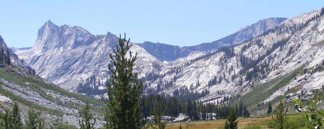
Sequoia Backcountry
The backcountry of Sequoia encompasses some 500,000 acres of the Sierra Nevada. With no road access, the forested hills and granite slopes are a hiker's paradise. Some 250 miles of trails travel through the mountains here, offering a wide range of choices for hikers and campers. A free backcountry permit is required for those venturing into this area, and may be picked up at the Visitor Center.
Kings Canyon National Park
Less visited than its neighbor, Kings Canyon National Park is larger and less developed. The only road into the main portion of the park is the Kings Canyon Highway, which travels through the Monarch Wilderness Area before reaching Roads End, with spectacular views of the Sierra Nevada. To explore the rest of the park you'll need a bike, a horse, or a good pair of hiking boots.
Giant Sequoia National Monument
With two disconnected sections bordering the national parks on the north and south, Giant Sequoia National Monument increases the amount of federally protected forests of the Sierra Nevada. More than 50 developed campgrounds make great alternatives to the sometimes crowded sites within the national parks, and some 800 miles of trails appeal to hikers and backpackers.
Casual visitors may enjoy the Trail of 100 Giants, with informative signage. A number of fishing opportunities such as Lake Isabella and the Kern River will tempt anglers. Scenic vistas of Kings River and the Needles, a series of massive granite formations, can be seen from the roads or on short hikes.
Some Other Things to Know
Pets
Please note that for you and your neighbors to see and appreciate wildlife, pets are not permitted on any of the trails in Sequoia and Kings Canyon National Parks.
In campgrounds and picnic areas, pets must be kept on a leash at all times. The leash must be less than 6 feet (1.8 meters) long. For your pet's safety, please don't leave pets in hot cars. Pets cannot be left tied and unattended at any time.
In the National Forest, pets are allowed on trails. But the leash must be less than 6 feet (1.8 meters) long.


